Project profile: Kapiti Expressway


|
|
|
|
|
|
|
|
|
|
|
|
Transport operators will notice a huge difference when the Mackays to Peka Peka Expressway opens ahead of schedule in late February
The sometimes controversial new highway, which in one form or another has been on the books since the 1940s, bypasses the lights and congestion at Paraparaumu and Waikane, but in the process drives right through the centre of the Raumati, Paraparaumu, and Waikanae residential and light industrial areas.
Some residents were furious about the build. However, the road had been on paper for a long time, and if people buying in the area had taken notice, they might have wondered why there were no buildings on the long swathe of land through the centre of a rapidly expanding suburban area.
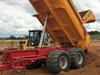
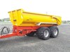
However, all that is history and the $630 million, 18km of four-lane expressway will soon be open for business with its 18 bridges accompanied by 16km of walking and cycle ways. About $1 million has been spent every working day on this project.
- There has been 3.5 million cubic metres of earth shifted for the project
- About 312,000 truckloads, or 2.5m cubic metres of aggregate has being placed
- 70,000 cubic metres of concrete poured
- 10,000 tonnes of reinforcing steel
- 150 hectares of landscape planting
The expressway is part of the Wellington Northern Corridor, which will stretch from Wellington airport to just north of Levin. The Wellington Northern Corridor is one of the government’s Roads of National Significance and will eventually link with the Transmission Gully project at Mackays Crossing, providing a through motorway from central Wellington to Peka Peka and eventually to Levin.
The Road Transport Forum is supportive of the entire Wellington Northern Corridor Project, Forum CEO Ken Shirley says.
"The Corridor is a necessary response to the projected growth of the region’s population and the increasing traffic between Levin and Wellington. The M2PP expressway will also help to provide a safer, more reliable, and more efficient route for heavy vehicles, while the second vehicular bridge across the Waikanae River will greatly add to the resilience of the route."
The existing SH1 at Kapiti will become a local road and some stretches have been upgraded in the process of establishing entrances and exits to the expressway. Designers have sought to improve accessibility through the Paraparaumu and Waikanae town centres, improve connections to and from rail and bus hubs, and enhance cycling and walking options between Poplar Avenue and Peka Peka.
Although the road will largely operate as a local arterial road, it will still have to function as an emergency bypass route between Poplar Avenue and Peka Peka in the event of an incident on the expressway. This has been a key factor in the design of any improvements.
Much of the evidence of the groundbreaking innovation being used is underground. The project has gone to great lengths to improve the ground at the bridges to stop liquefaction around the bridge foundations. At the Waikanae River, for example, the piles of the new bridge are three metres in diameter and up to 40m deep. All have been designed to withstand the combined effects of large (one in 2500 years) earthquakes and liquefaction. Many lessons from Christchurch have been considered as well as international seismic design standards.
Apart from being essentially flat, it has not been the easiest country to design heavyweight roads for. Much of the land is marshy or on a shingle or sand footing, so a lot of land has been stripped back and quarried rock substituted.
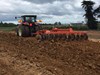
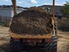
Planting the berms of the expressway has involved the largest planting exercises ever seen in the lower North Island, involving 1.4 million locally sourced, primarily native plants to cover 140 hectares of land. That’s the equivalent to 25 plants for every Kapiti resident.
The area of wetland habitat on the Kapiti Coast also gets a boost with five hectares of wetland replacing every hectare lost or removed because of the expressway’s construction.
M2PP Alliance project manager John Palm said the project is more than just an expressway.
"We wanted to create a scenic drive, a shared pathway, and an enduring corridor of plant life. The work will improve the local biodiversity and ecological connections on the Kapiti Coast, helping flora and fauna to thrive."
It is expected that local bird, lizard, and native fish populations grow as a result of the landscaping and planting work.
A simulated flyover of Mackays to Peka Peka and a flyover of the connecting projects to Otaki and Transmission Gully is available on YouTube
Keep up to date in the industry by signing up to Deals on Wheels' free newsletter or liking us on Facebook.